


Croix de Jaume GR1

michel38
User

Length
11.7 km

Max alt
1667 m

Uphill gradient
489 m
Km-Effort
18.3 km

Min alt
1224 m

Downhill gradient
489 m
Boucle
Yes
Creation date :
2025-05-26 13:46:21.376
Updated on :
2025-05-26 13:47:04.876
4h08
Difficulty : Difficult

FREE GPS app for hiking
 SityTrail
IGN / Geographical institutes
SityTrail Plus
The world is yours!
About
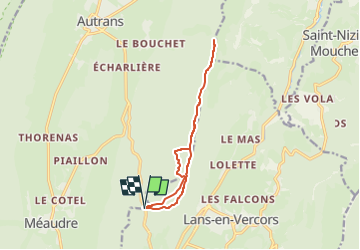
Trail Walking of 11.7 km to be discovered at Auvergne-Rhône-Alpes, Isère, Autrans-Méaudre en Vercors. This trail is proposed by michel38.
Positioning
Country:
France
Region :
Auvergne-Rhône-Alpes
Department/Province :
Isère
Municipality :
Autrans-Méaudre en Vercors
Location:
Méaudre
Start:(Dec)
Start:(UTM)
701280 ; 5000631 (31T) N.
Comments